Interactive maps
Map your sites and buildings
Configure your sites and buildings
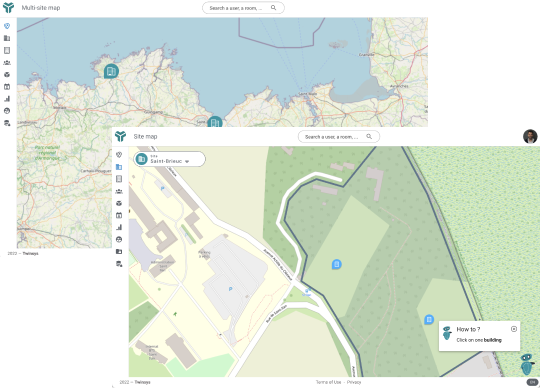
Geolocate your different sites all over the world.
Draw the footprint of each site with the position of each building.
Add points of interest for your users such as public transport stops pointing to timetables.
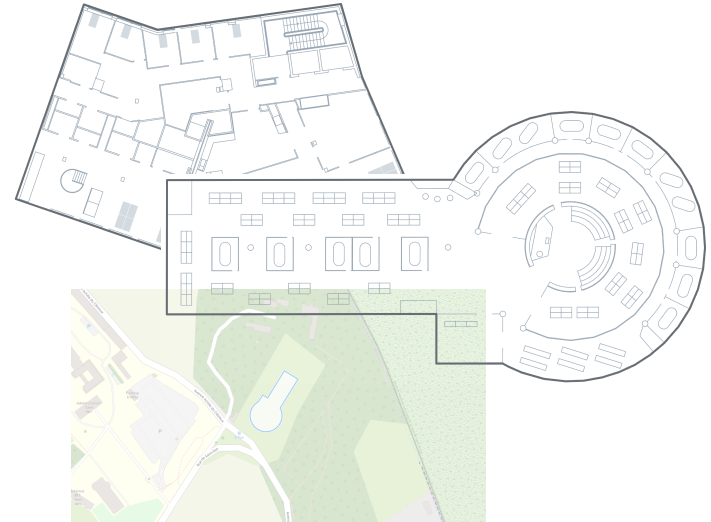
Import your floor plans
Import your AutoCad plans directly into the application and position the site footprint.
No need to be an AutoCad expert, we support you in setting up and updating your plans.
A layout change (desk move, room splitted, etc)? Simply Change your architect’s plan and update the application by yourself.
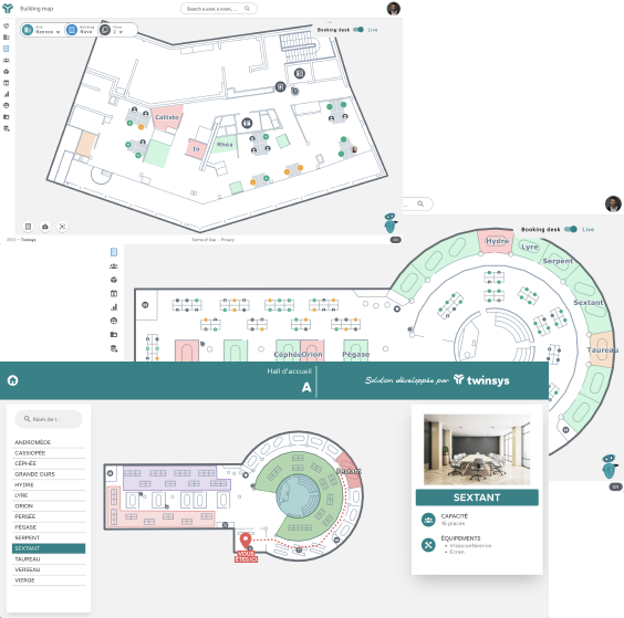
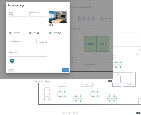
Configure the elements to be supervised
Configure each of your rooms: their capacity, the associated equipments, …
Define which desks are bookable and the teams zones
Add the available equipments: coffee machines, printers, fire extinguishers, defibrillators
An interactive map for multiple uses
Interactive map to view the use of spaces in real time (occupation) and future reservations.
Find a colleague, book a desk, a meeting room directly from the interactive map.
In one click, visualize the position of the first aiders
Geolocalize your incident reports.
Kiosk for information and guidance of your visitors.